National Forest Fire Information System (NFFIS)
The National Forest Fire Information System (NFFIS) is an advanced web-based Geographic Information System (GIS) platform specially designed to combat forest fires through proactive measures, early warning systems, and efficient fire management strategies. NFFIS operates as an all-encompassing system, aggregating diverse data from multiple sources to create a comprehensive and dynamic geospatial database.
Among the key data sources integrated into NFFIS are the following:
1. MODIS Satellite Data: NFFIS incorporates real-time information from the Moderate Resolution Imaging Spectroradiometer (MODIS) satellites. This satellite data plays a vital role in actively detecting and monitoring active fire incidents.
2. Automatic Weather Stations (AWS): NFFIS collects and analyzes real-time weather data from Automatic Weather Stations strategically positioned across the region. This data includes crucial parameters such as temperature, humidity, and wind speed, providing critical insights into fire weather conditions.
3. Data from Kosovo Cadastre Agency (KCA): NFFIS incorporates land use information and base maps, such as topographic maps and orthophotos, from the Kosovo Cadastre Agency (KCA). These maps serve as the foundation for accurate spatial analysis and decision-making.
4. Data from Kosovo Forest Agency (KFA): Forest management data from the Kosovo Forest Agency (KFA), including forest management units, compartments, and stands, are essential for effective forest fire planning and response.
5. Data from Institute of Hydro-Meteorology of Kosovo (IHMK): NFFIS includes data from the Institute of Hydro-Meteorology of Kosovo (IHMK), particularly data from their network of Automatic Weather Stations (AWS), which further enhances the systems capacity to monitor weather conditions.
6. Data from Kosovo Environmental Protection Agency (AME): NFFIS integrates protected area data from the Kosovo Environmental Protection Agency (AME). This information aids in assessing fire risks in ecologically sensitive regions.
7. Data from Emergency Management Agency (EMA): Critical data from the Emergency Management Agency (EMA) includes locations of police stations, health centers, fire stations, and other emergency response facilities. This data is vital for optimizing fire incident reporting and rapid emergency response.
By combining and processing data from these key stakeholders, NFFIS empowers forest management agencies, firefighting teams, and policymakers with real-time insights and efficient tools for forest fire prevention, emergency preparedness, and sustainable forest management practices. The collaborative and holistic approach of NFFIS ensures a safer and more resilient environment for Kosovo forests and communities.
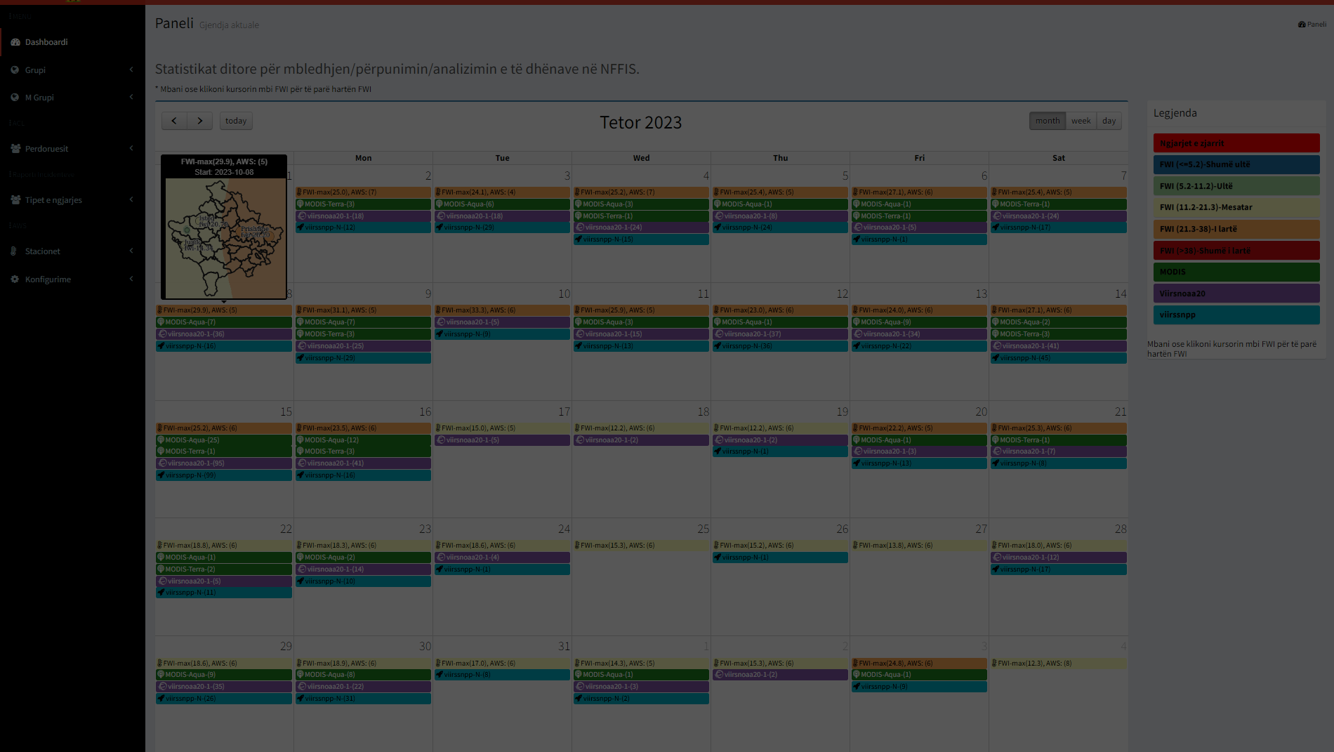
Data Collection and Analysis:
MODIS satellite data provides crucial information on active fire detection and monitoring, while AWS records real-time weather conditions like temperature, humidity, and wind speed. NFFIS systematically analyzes this data to identify hotspot locations and generate important fire management insights.
Geospatial Products:
NFFIS leverages the collected data to create essential geospatial products, such as the Fire Weather Index (FWI) and Vegetation Dryness maps. The FWI index helps assess fire danger levels, while Vegetation Dryness maps indicate areas susceptible to rapid fire spread, aiding in timely fire suppression strategies.
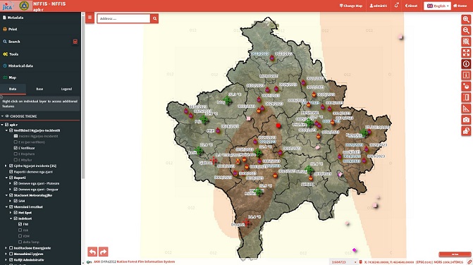
Risk and Incident Reports:
NFFIS generates Risk maps that help stakeholders assess fire-prone regions, enabling proactive planning and resource allocation. Moreover, the system facilitates real-time Incident Reports, allowing citizens and stakeholders to directly report fire incidents, ensuring a swift response to emergent situations.
Collaborative Data Integration:
NFFIS collaborates with key stakeholders, including APK (Agjencioni Pyjore i Kosoves), IHMK (Instituti Hidro-meteorologjik Kosoves), AKK (Agjencia Kadastrale e Kosoves), AMMK (Agjencia Mbrojtjes Mjedisit), and more. Data from these entities, like forest management plans, meteorological information, and environmental protection data, is seamlessly integrated into NFFIS for comprehensive forest management.
Stakeholders:
Donation:
This project is financed and donated by JICA (Japan International Cooperation Agency) to AME (Agjencia Mbrojtjes Mjedisit) and the Government of Kosovo. The support from JICA demonstrates the collaborative efforts between Japan and Kosovo in enhancing forest fire management and protecting the environment.
Development of NFFIS:
NFFIS is proudly developed by Geoland, a leading geospatial solutions company in Kosovo. With their expertise and dedication, Geoland has created this state-of-the-art web-GIS platform to strengthen forest fire prevention and management capabilities.
NFFIS plays a crucial role in empowering forest management agencies, firefighters, and policymakers with real-time data and comprehensive geospatial insights. By utilizing the collective expertise and data from diverse stakeholders, NFFIS strengthens forest fire prevention efforts, enhances emergency response capabilities, and safeguards natural resources for a more resilient and sustainable environment.


